


| Location of Colorado Springs |
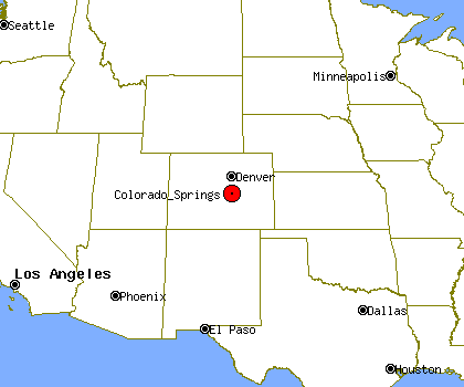
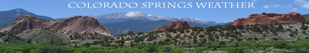
Colorado Springs is situated near the base of one of the most famous American mountains, Pikes Peak, rising over 8,000 feet above the city on the eastern edge of the Southern Rocky Mountains. Colorado Springs is located in the east central portion of the state. It is situated on Fountain Creek and is located 60 miles (97 km) south of the Colorado State Capitol in Denver. At 6,035 feet (1,839 m) the city stands over one mile (1.6 km) above sea level, though some areas of the city are significantly higher and lower.
| About This Station |
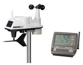
The station is powered by a Davis Vantage Vue weather station. The data is collected every second and the site is updated every 5 seconds. This site and its data is collected using Weather Display Software. The station is comprised of an anemometer, a rain gauge and a thermo-hydro sensor situated in optimal positions for highest accuracy possible. The Website was Created on April 4,2014 and is located in Colorado Springs, Colorado.
| About Colorado Springs |
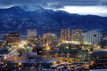
Colorado Springs is a Home Rule Municipality that is the county seat and most populous city of El Paso County, Colorado, United States. The city had an estimated population of 431,834 in 2012 being the second most populous city in the state of Colorado, behind Denver, and the 41st most populous city in the United States, while the Colorado Springs Metropolitan Statistical Area had an estimated population of 668,353 in 2012. The city covers 194.7 square miles (504 km2), making it Colorado's largest city in area. Colorado Springs was selected as the No. 1 Best Big City in "Best Places to Live" by Money magazine in 2006, and placed number one in Outside's 2009 list of America's Best Cities.
| History of Colorado Springs |
Ute, Arapahoe and Cheyenne peoples were the first to use the area which would become Colorado Springs. Part of the territory included in the United States' 1803 Louisiana Purchase, the current city area was designated part of the 1854 Kansas Territory. In 1859 after the first local settlement was established, it became part of the Jefferson Territory on October 24 and of El Paso County on November 28. Colorado City at the Front Range confluence of Fountain and Camp creeks was "formally organized on August 13, 1859" during the Pikes Peak Gold Rush. It served as the capital of the Colorado Territory from November 5, 1861, until August 14, 1862 when it was moved to the Denver City.In 1871 the Colorado Springs Company laid out the towns of La Font (later called Manitou Springs) and Fountain Colony, upstream and downstream respectively, of Colorado City.[12] Within a year, Fountain Colony would be renamed Colorado Springs, and was officially incorporated.[13] The El Paso County seat shifted from Colorado City in 1873 to the Town of Colorado Springs.[14] On December 1, 1880, Colorado Springs expanded northward with 2 annexations.[15] [16] The 2nd period of annexations was during 1889-90, and included Seavey's Addition, West Colorado Springs, East End, and another North End addition. In 1891 the Broadmoor Land Company built the the Broadmoor suburb, which included the Broadmoor Casino, and by December 12, 1895, the city had "four Mining Exchanges and 275 mining brokers." By 1898, the city was designated into quadrants by the north-south Cascade Avenue and the east-west Washington/Pike's Peak avenues.:10 From 1899 to 1901 Tesla Experimental Station operated on Knob Hill, and aircraft flights to the Broadmoor's neighboring fields began in 1919. The Alexander Airport north of the city opened in 1925 and in 1927, the Original Colorado Springs Municipal Airport land was purchased east of the city. Space Command - Petersen AFB Building 1 In World War II the United States Army Air Forces leased land adjacent to the municipal airfield, naming it "Peterson Field" in December 1942. This was only one of several military presences in and around Colorado Springs during the war. In November 1950, the Headquarters Area, Colorado Springs, was selected as the Cold War headquarters for Air Defense Command (ADC)--later renamed Ent Air Force Base. The former WWII Army Air Base, Peterson Field, which had been inactivated at the end of the war, was re-opened in 1951 as a USAF base. The 1950s through 1970s saw a continued expansion of the military presence in the area with the establishment of NORADs headquarters in the city, as well as the ADCOM Headquarters. Between 1965 and 1968 the University of Colorado at Colorado Springs, Pikes Peak Community College and the Colorado Technical University were established in or near the city. In 1977, most of the former Ent AFB became a US Olympic Training Center. The Space Command headquarters was established in Colorado springs in 1982, where it remained until relocating to another city in 1987. On October 1, 1981, "the Broadmoor Addition", Cheyenne Canon, Ivywild, Skyway, and Stratton Meadows were annexed after the Colorado Supreme Court "overturned a district court decision that voided the annexation". Further annexations expanding the city include the "Nielson Addition" and "Vineyard Commerce Park Annexation" in September 2008.
| How Does It Work? |
The Davis Vantage Vue weather station console receives data from the various sensors. The console is then connected to computer (On 24/7) with 8GB of RAM running Windows 7. A software program called Weather Display captures all the data and then SFTP's (Secure File Transfer Protocol) the information to the web site for everyone to see (hosted by IONOS). Windows Task Scheduler is running a script on a home built PC every 5 minutes checking for alerts from the NWS.