

Drought Monitor
Current U.S. drought conditions plus Colorado and Colorado Springs drought resources, precipitation monitoring, outlooks and water-supply information.
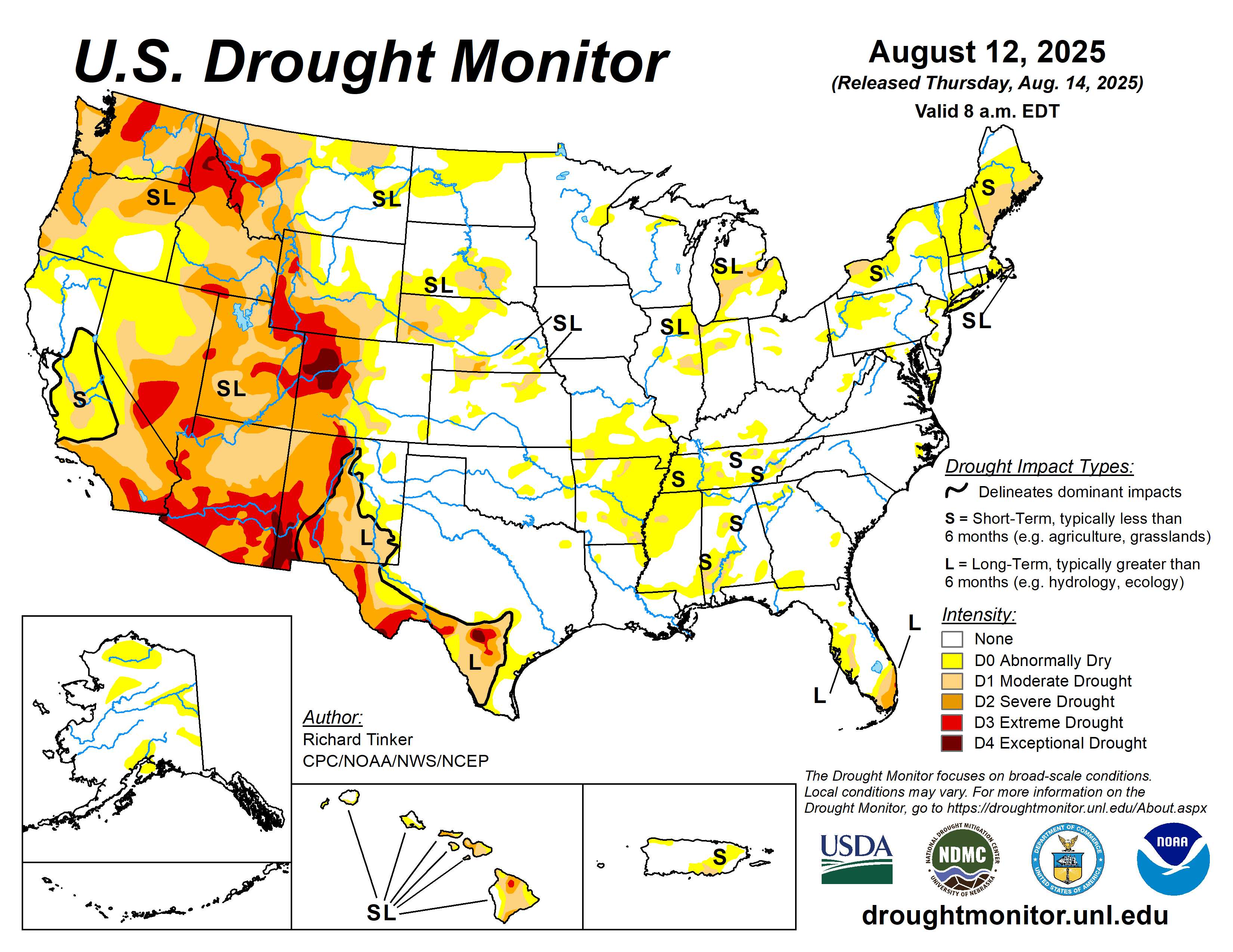
Current U.S. Drought Monitor
The U.S. Drought Monitor classifies drought from D0, Abnormally Dry, through D4, Exceptional Drought.
What Drought Monitoring Uses
Drought assessment considers multiple indicators, including precipitation, temperature, soil moisture, streamflow, reservoir conditions and reported impacts.
Short-Term vs. Long-Term
Short-term drought can affect agriculture and grasslands, while longer-term drought can affect groundwater, reservoirs, streamflow and ecosystems.
Why Local Conditions Matter
A national drought category is broad-scale guidance. Conditions around Colorado Springs and El Paso County can vary with elevation, rainfall, snowpack and local water supply.
Colorado & Colorado Springs Drought Resources
Additional official tools for current conditions, precipitation, water supply and future drought outlooks.

